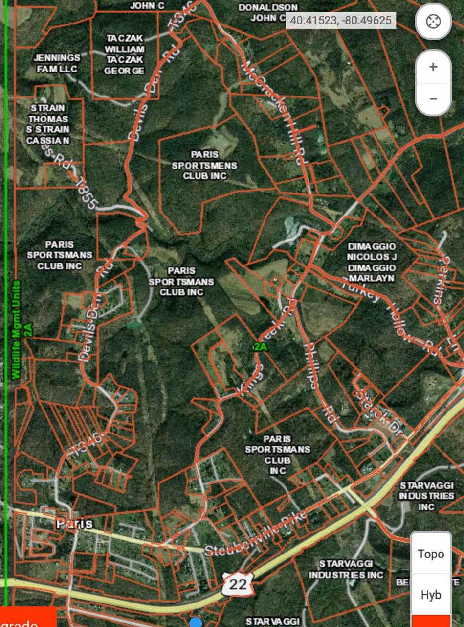
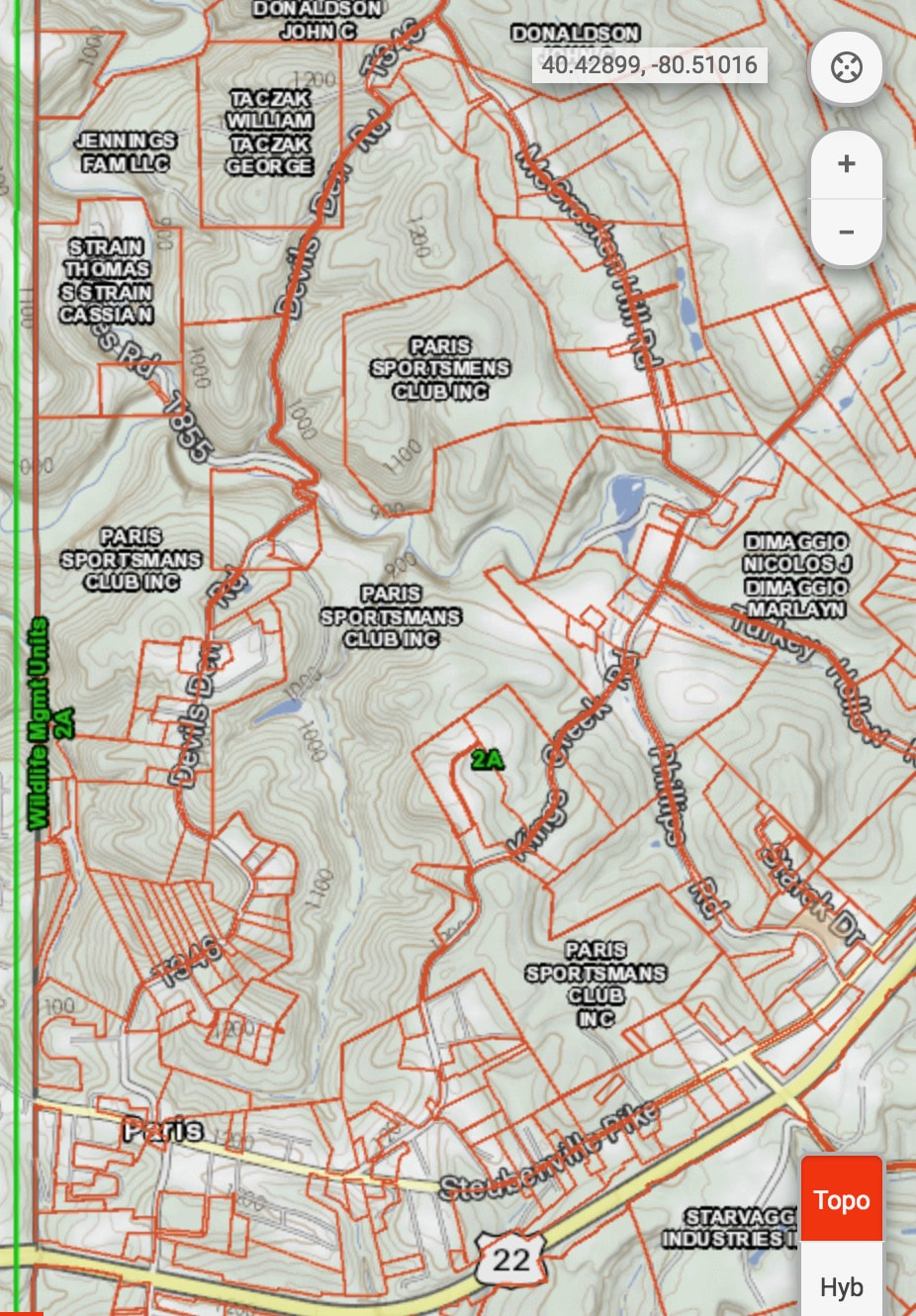
PSC Maps
Below are a few maps for property owned by PSC.
The higher resolution maps are almost 4 mg each and the low resolution maps are about 1 mg each - so be aware that if you are on your phone or tablet, this may count against your total data usage.
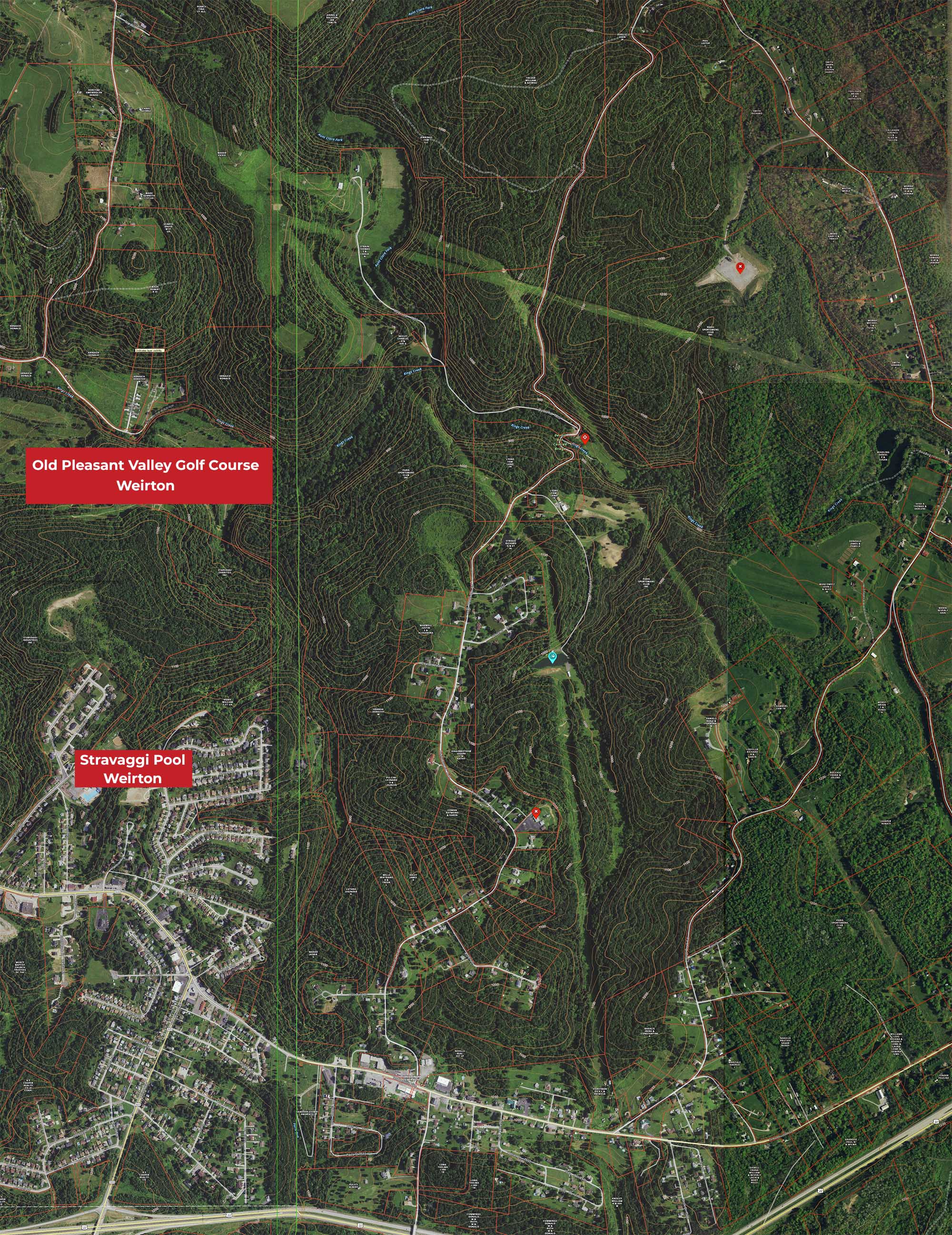
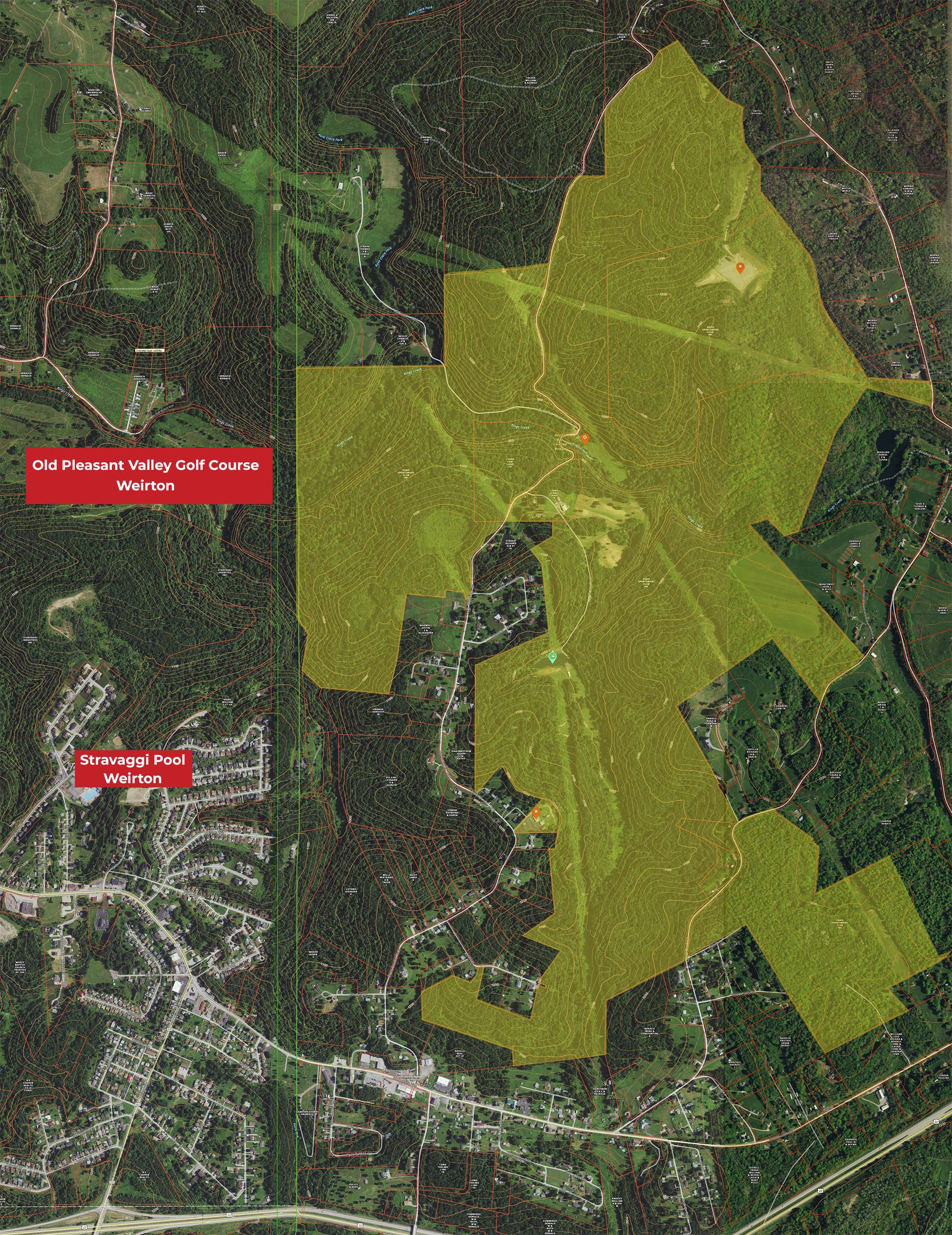
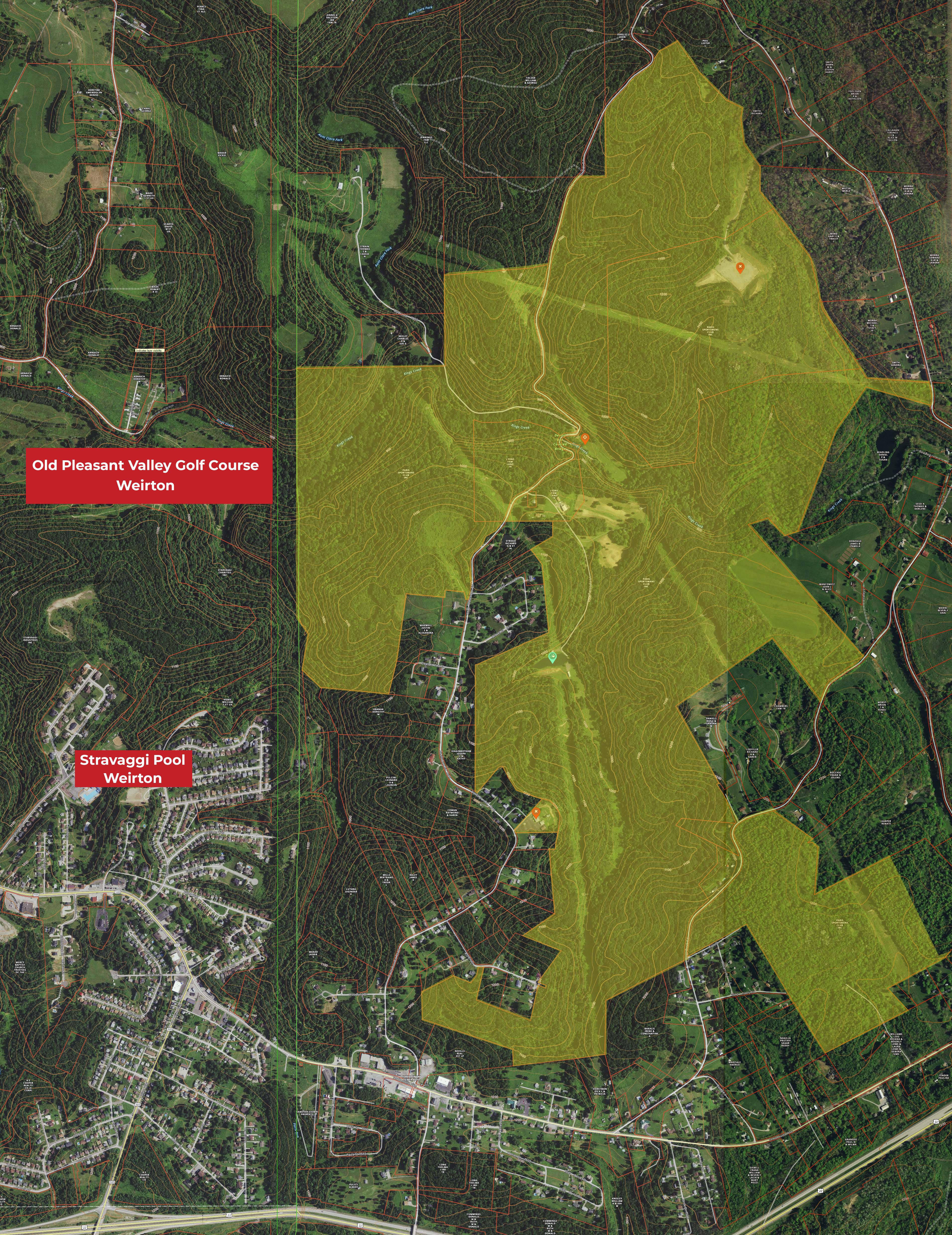
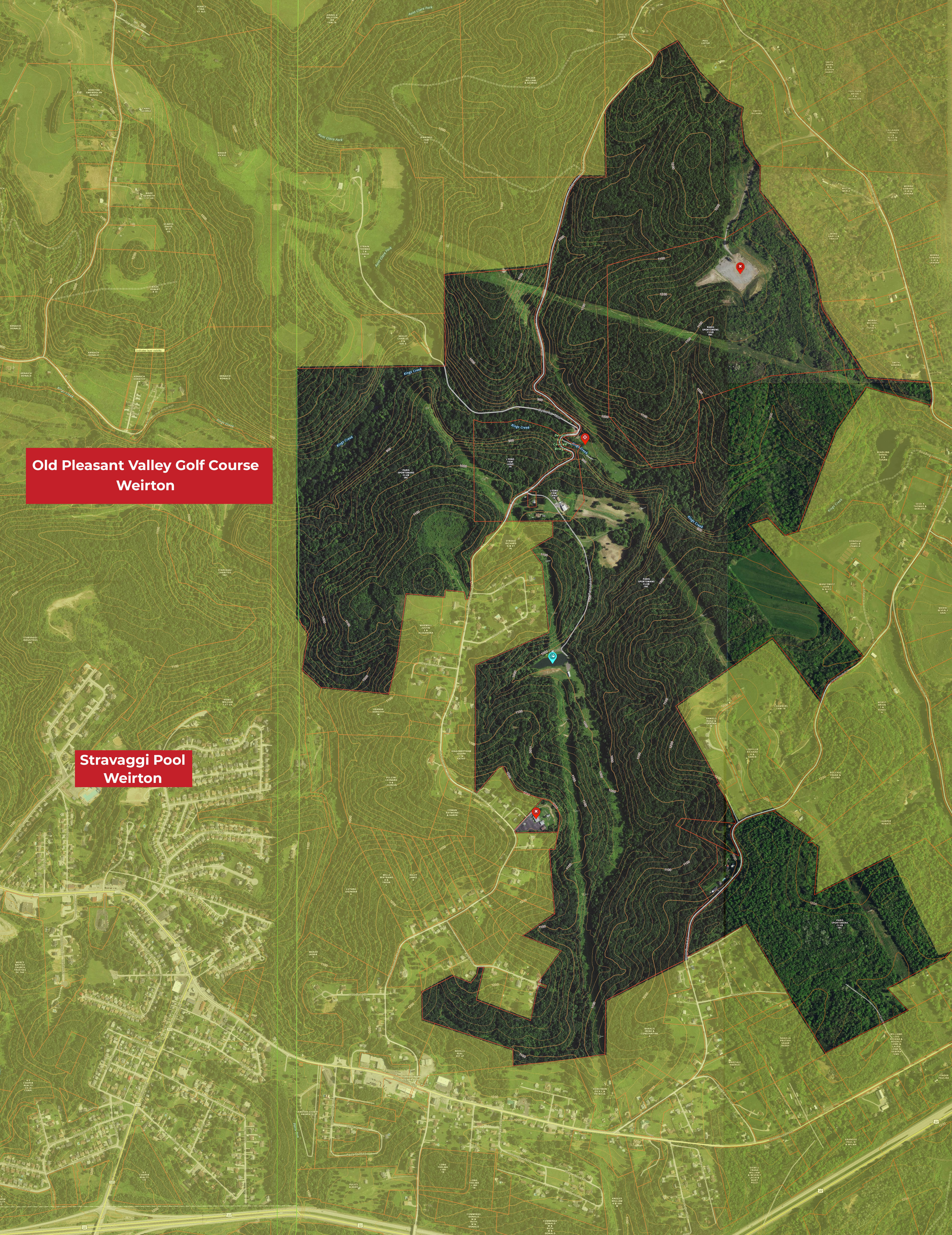
There are markers for the Main Hall, the Lake, the Gun Range and the Well Pad.
These were composed by using online data, so some areas may not be marked precisely. It is up to you as a conscientious hunter and outdoor enthusiast to be mindful of your location and to respect the club property and areas belonging to our neighboring property owners.
The higher resolution maps are almost 4 mg each and the low resolution maps are about 1 mg each - so be aware that if you are on your phone or tablet, this may count against your total data usage.
There are markers for the Main Hall, the Lake, the Gun Range and the Well Pad.
These were composed by using online data, so some areas may not be marked precisely. It is up to you as a conscientious hunter and outdoor enthusiast to be mindful of your location and to respect the club property and areas belonging to our neighboring property owners.
Low Resolution maps - This first row of maps links to low resolution files that will not show much detail
|
|

|
High Resolution maps - This second row of maps links to a higher resolution files that will show more detail

|
|
|
Lake
Hanover Township
Pennsylvania
40.417464, -80.506930
https://www.google.com/maps/@40.416776,-80.5097056,553m/data=!3m1!1e3
Gun Range
Hanover Township
Pennsylvania
40.42431, -80.505155
https://www.google.com/maps/@40.4244447,-80.5080099,725m/data=!3m1!1e3
Hanover Township
Pennsylvania
40.417464, -80.506930
https://www.google.com/maps/@40.416776,-80.5097056,553m/data=!3m1!1e3
Gun Range
Hanover Township
Pennsylvania
40.42431, -80.505155
https://www.google.com/maps/@40.4244447,-80.5080099,725m/data=!3m1!1e3
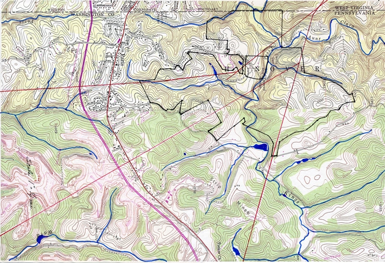
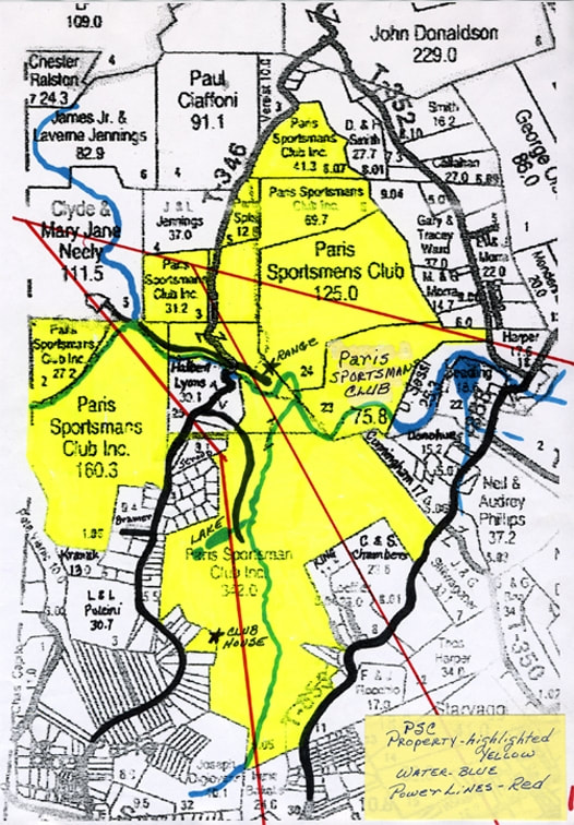
Older maps
Topographic and property maps for our club
Topographic and property maps for our club